

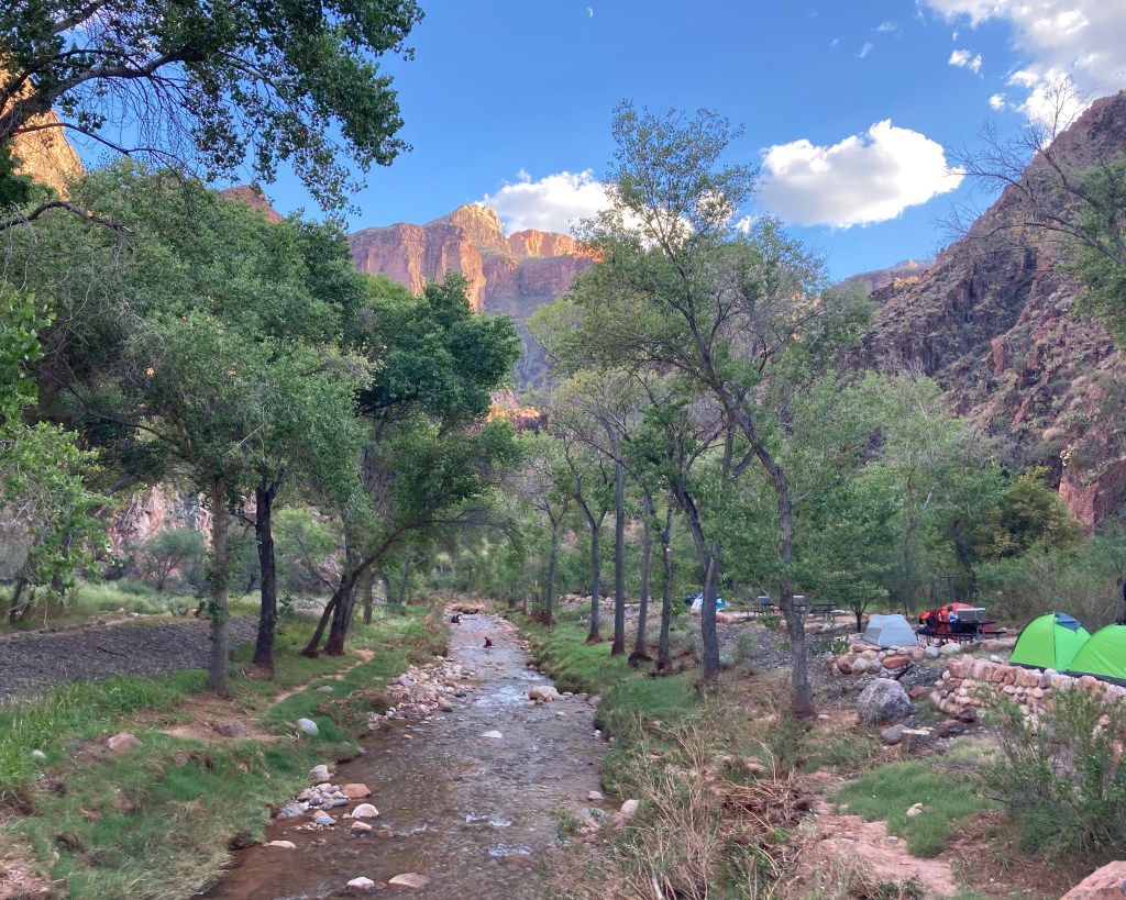


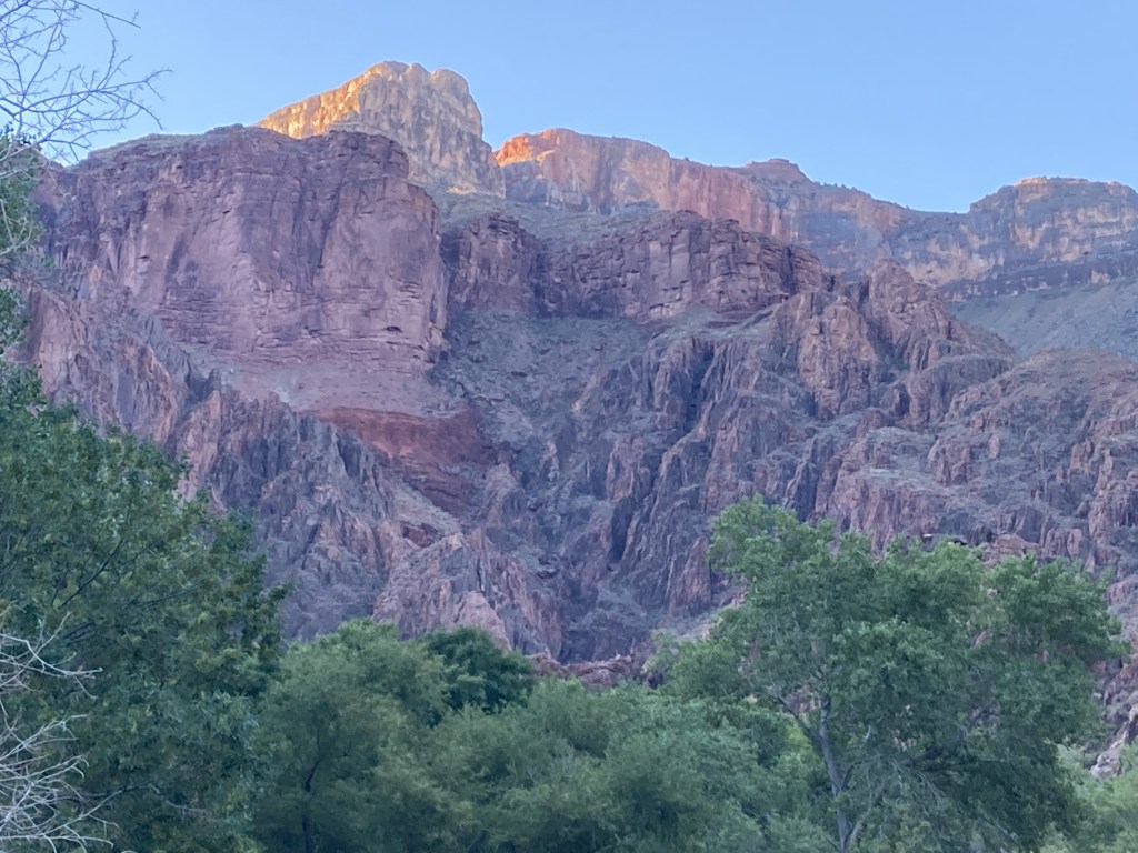
3 sets of rocks above the Cottonwood trees at Bright Angel Campground – Looking south across the Colorado River (not visible) at Tip Off Fault.
Interpretation certainty: fairly certain – I have photos from multiple visits with slightly different perspectives of the trail, camp, and cliffs. The trail that runs through the BA Camp points at the Tipoff fault. Sources (listed on home page): Billingley 2000 30×60 Quadrangle Map, Clark 2013 interactive map, Page 206 on https://irma.nps.gov/DataStore/DownloadFile/618707, and Google Earth.
(1) Vishnu Basement Rocks – This basement rock is Brahma Schist. It is 1.75 billion years old (1750 Ma). It appears dark grey & pink in this photo. Its layers have been compressed vertically from long ago plate collisions. It is made of volcanic and sedimentary materials from volcanic islands and pink colored granite from the magma below the volcanic islands.
(2) Grand Canyon Supergroup – On the left side of the photo above the Brahma Schist, a small patch of Supergroup rocks sits along the eastern side of Tipoff Fault. They likely survived total erosion by dipping between Tipoff and Cremation faults where they were somewhat shielded from weathering. The Cremation Fault is not in view but just farther east (left). In the photo’s center left: the Bass Formation (1255 Ma) is visible as a small V shaped cliff that is dark brown at the bottom and reddish brown at the top. Above it is a slope of Hakatai Shale (1230 Ma) that is light reddish brown. Sitting on the Hakatai is a prominent cliff of Shinumo Sandstone (1130 Ma), which in this light appears a pinkish beige with darker splotches of brownish grey.
(3) Layered Paleozoic Rocks – Tapeats cliffs overlying Brahma Schist in the center and on the right. Above Tapeats it’s easy to see the broad slope off Bright Angel Shale that sits about 1/2 way down canyon. The BA Shale also sits directly on the Shinumo, though it’s hard to see. Also hard to see are the Muav above the BA Shale, and above that some areas of Temple Butte directly under the towering Redwall cliff
…or in this case, cliffs! They are both glowing in the morning light. Between them is a fault where erosion in the Redwall allows the South Kaibab Trail to descend from Skeleton Point in switchbacks heading east (trail not visible from this view).
In the upper left corner where the cliff is most receded (behind bare tree branches in the foreground), you can imagine the South Kaibab Trail just above, reaching The Tipoff rest area and descending from the BA Shale into Shinumo.
A small glowing band of Coconino is visible on the far upper right of the photo – maybe near Mather Point.
This photo captures three unconformities where geological time is missing between sets of rocks. Geological time is not just about years, but also the events they represent in the history of the planet.
The Great Unconformity – 1.2 billion years of missing geological time! In this photo the Tapeats Sandstone (508 Ma) sits directly on the Brahma Schist to the West (right) of Tip Off Fault.
Angular unconformity – In this photo the Bright Angel Shale (506 Ma) overlies Shinumo Sandstone to the East (left) of Tip Off Fault.
The Greatest Angular Unconformity – In this photo the Bass Formation overlies Brahma Schist.
-Sept 13, 2021 at 6:42 AM
